
Conwy railway arch

![]()
 Many of Britain’s medieval features were demolished in later centuries as new roads and railways were built, but Conwy was an exception. New arches were created in the medieval town walls for the railway and for all but one of the new roads into the walled town.
The railway arch near Conwy station represents an exceptional effort to mitigate the damage caused by building the Chester & Holyhead Railway through the walled town in the 1840s. Robert Stephenson oversaw the main engineering elements.
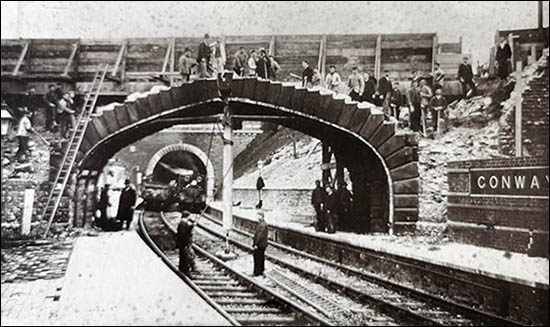 The railway company erected a broad, Gothic archway over the tracks. It emulates the walls’ castellated parapet and continues the line of the wall walk – the elevated footway for medieval soldiers to defend the town. A small section of the original arch was later hacked away at the eastern end as trains became larger and the arch threatened to foul coach roofs as they rounded the curve.
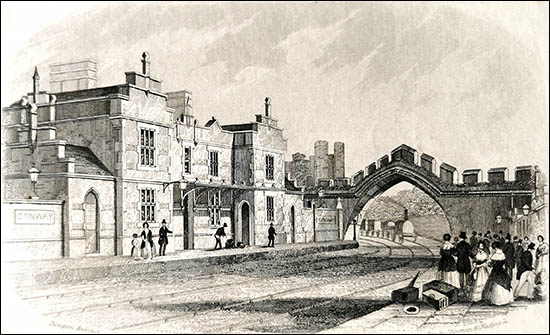
The upper photo, courtesy of Conwy Archive Service, looks the other way, showing how the Rosemary Lane bridge had an elegant stone arch – complementing the arch in the town walls – before the present one was installed.

To the west of the railway arch you can see a smaller arch in the town walls. This was originally associated with a siding to the railway signals depot, which was in the space now occupied by the Twr Llywelyn housing complex. The depot manager lived in Rosemary Cottage. This arch is now used by pedestrians, and by cars accessing Twr Llywelyn.
The aerial photo, courtesy of the Royal Commission on the Ancient & Historical Monuments of Wales, shows both arches in 1923. It is from the Aerofilms Collection of the National Monuments Record of Wales.
Where the railway leaves the walled town further north, there’s no exit wound in the town walls because the track runs in tunnel beneath the walls. The tunneling appears to have caused a section of the tower above to lower, opening two cracks in the masonry.
Postcode: LL32 8HY View Location Map
Website of Conwy Archive Service
Copies of the old aerial photo and other images are available from the RCAHMW. Contact: nmr.wales@rcahmw.gov.uk